Summary
A LiDAR sensor can outperform photogrammetry in situations where accuracy and detail are critical. While photogrammetry remains a cost-effective and highly accessible method for creating realistic 3D models, a LiDAR sensor excels in powerline inspections, indoor mapping, and forestry surveys thanks to its ability to directly measure surfaces with laser pulses. This article explores the evolution of LiDAR sensors, their advantages over photogrammetry in specific use cases, and how combining both technologies in 3Dsurvey software allows surveyors to achieve the most reliable results.
Introduction
By nature, we are photogrammetry enthusiasts. We have been working with this technology for over 15 years, and it still surprises us every time we process a new project. The fact that you can achieve such high-quality results with minimal equipment—whether it’s a smartphone camera or a consumer-grade drone like the DJI Matrice 4E—is simply amazing. Once you generate the point cloud and mesh, the level of detail and realism is often unbelievable.
The evolution of a LiDAR sensor
Our journey with the LiDAR sensor began later, when the first affordable devices reached the market. Early solutions were far from practical: you had to integrate a drone with a LiDAR sensor yourself (or hire a third-party company), which often led to errors, equipment malfunctions, heavy payloads, and sky-high costs. For most surveying companies, LiDAR was out of reach.
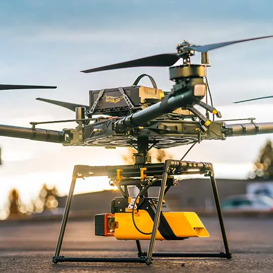
That changed with DJI’s release of the Matrice 300 paired with the L1 LiDAR sensor. This was the first truly user-friendly setup suitable for:
- surveying,
- construction,
- and powerline inspection.
Still, the L1 produced too much noise to deliver the precision surveyors needed.
Later, DJI introduced the L2 LiDAR sensor, which significantly reduced noise levels and made the technology much more reliable. Today, other providers such as YellowScan, Riegl, and Stonex also offer advanced LiDAR sensors—some solid-state, some mechanical. However, prices often start at €40,000+, which stands in stark contrast to photogrammetry’s low entry cost.
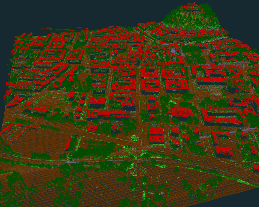
Why a LiDAR sensor can outperform photogrammetry?
The difference lies in how the two technologies work.
Photogrammetry reconstructs geometry from overlapping images, while a LiDAR sensor sends out laser pulses, measures their return time, and calculates the exact reflection point. This direct measurement approach gives LiDAR several advantages in specific cases.
Here are three real-world scenarios where a LiDAR sensor clearly outperforms photogrammetry.
1. Powerline Inspections
Capturing detailed and accurate point clouds of powerlines with photogrammetry is extremely challenging.
A LiDAR sensor makes this simple: laser pulses easily reflect off cables, ensuring the point cloud contains the complete geometry. You can achieve this using a drone-mounted LiDAR sensor or by walking beneath the powerlines with SLAM technology.


2. Indoor Mapping
Indoor environments are usually difficult for photogrammetry due to low light, uniform colors, and flat textures. A LiDAR sensor with SLAM technology excels here. You can walk through a building, capture points room by room, and close the loop at your starting point. In just 15 minutes, it’s possible to collect a full 3D dataset of a three-story building with 15 rooms—something photogrammetry would struggle to achieve.
We went in-depth on this in our webinar, which you can re-watch here.
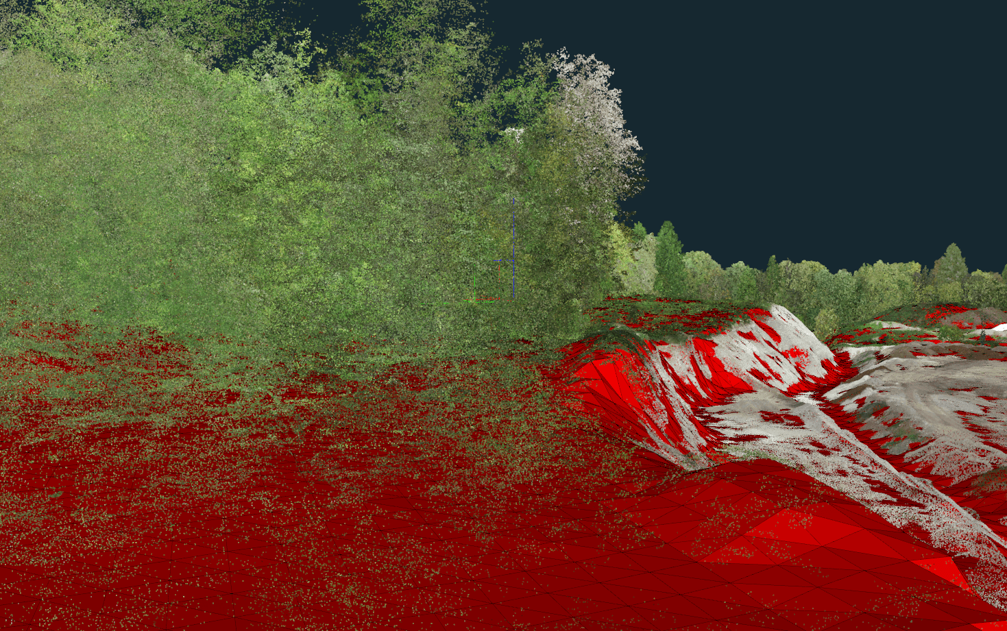
3. Forestry Mapping
When you need a terrain model beneath dense forest canopies, photogrammetry often falls short. A LiDAR sensor solves this with multiple returns: a single laser pulse can capture reflections from the treetop, branches, and the ground. This makes LiDAR essential for forestry surveys and accurate terrain modeling.
Conclusion: LiDAR sensor or photogrammetry?
Both technologies have unique strengths:
- Photogrammetry is best for open areas, stockpile volume measurements, open-pit mining, survey data collection, and creating realistic 3D models for visualization. If you want to better understand how a photogrammetry software works, follow the link.
- A LiDAR sensor is the superior choice for indoor mapping, powerline inspection, and terrain modeling under dense vegetation.
The good news is that you don’t have to choose one over the other. With 3Dsurvey, you can seamlessly merge LiDAR sensor data and photogrammetry results in a single software environment—with no limitations. This is just one of the reasons why 3Dsurvey is the best photogrammetry software in 2025.

