A smartphone (Google Pixel) was used to capture 182 photos of a house’s interior.
3 ground control points (GCPs) allowed accurate geo-referencing without expensive indoor GPS equipment.
Using a 75–80% overlap strategy across rooms enabled precise 3D reconstruction.
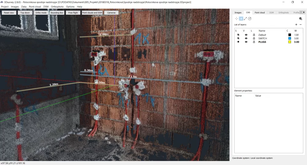
The resulting 3D point cloud allowed measuring distances, such as internal cabling, with centimetre-grade accuracy.
The model served as a basis for architectural work (e.g., interior plans, furniture design) in ArchiCAD.
This workflow saved more than 30% of the time compared to traditional surveying.
It supports future maintenance: all infrastructure (electric, plumbing) is geo-documented and easy to reference.
Introduction
This project demonstrates how to utilize 3Dsurvey software to map the interior of a house for installation and infrastructure.
An architectural firm used a smartphone to capture 2D images and processed them with 3Dsurvey software to automatically get geo-referenced and highly detailed 3D results.
The future of indoor mapping
Are traditional methods ready to be upgraded?
Traditional mapping and surveying methods are being replaced by digital approaches. However, this does not mean they should be left out of the picture completely. Mainly it motivates us to start trusting and relying more on modern technology and digital solutions.
With the use of photogrammetric software, the client saved more than 30% of time in the field and was able to generate highly representative data along with 3D visualization and interior plan.
Utilizing 3Dsurvey’s orientation and geo-referencing wizard the client was able to position all cables and infrastructure with a cm-grade accuracy. Such data massively helps with the finishing of overall construction works and with maintenance later in the life-cycle of the house. For example, in case of drilling holes, etc. the data is recorded is easily accessible.
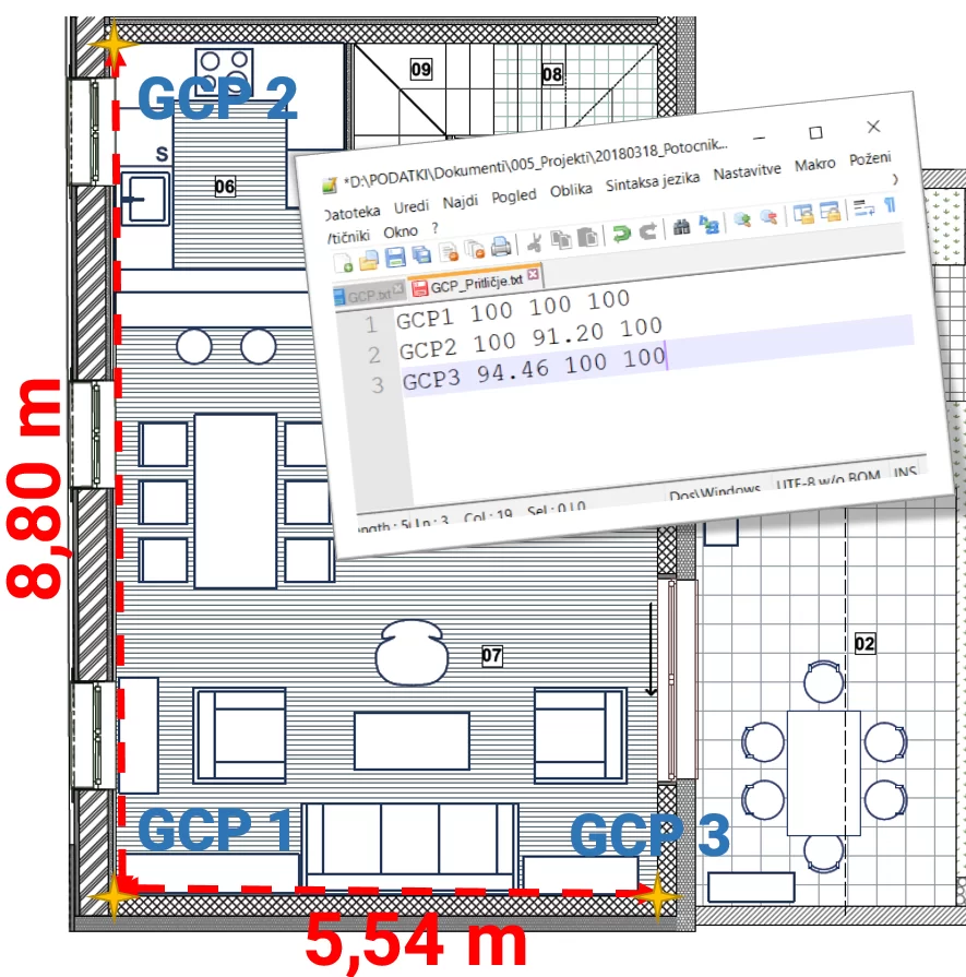
Placing ground control points
To get the most accurate data, GCPs (ground control points) were used for orientation of the 3D model. Because of GCPs there is no need to use expensive measuring equipment such as total station. GPS devices can be hard to work with inside a house due to lack of GPS connection, etc. All we needed was to measure the GCPs and define the coordinates with the aid of a measuring tape. Measurements were written in *txt file which were imported into 3Dsurvey.
To avoid getting results shown in negative Y axis, elevation is best set to a position above ground level – 100m in this case.
Capturing images
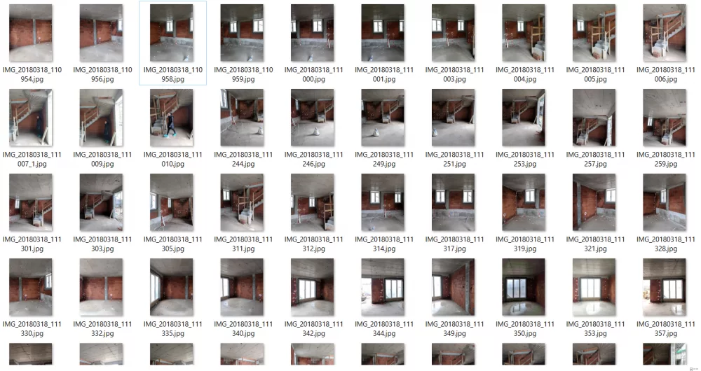
On the ground floor 77 images with 75-80% overlap were taken. Details must be seen on at least 3 images for the automatic algorithms to perform properly and deliver precise and accurate end results. The same workflow was repeated in the upper floor (115 photos were taken).
Tips for best results
To achieve the best results it is important to follow a certain workflow and to position yourself correctly inside a room.
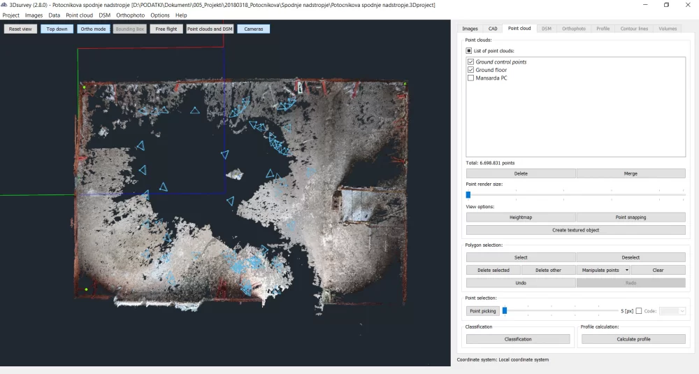
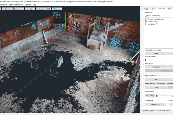
Try to avoid positioning yourself in the center of the room and taking pictures around you. It’s far better to position yourself against the wall and take pictures in half-circle. See the screenshot below for a better representation of camera positions in this particular project.
Because the levels are connected only via the staircase it was very difficult to map the entire house in one project. Therefore we did it in two separate projects. For the GCPs we used the same coordinates, adding 3m of height since the height of the ceiling is 2,70 m + the thickness of the panel 0,3. The orientation works well in this way and fits together.
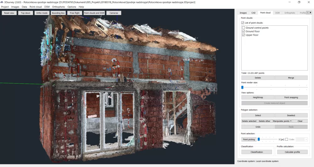
3D point cloud
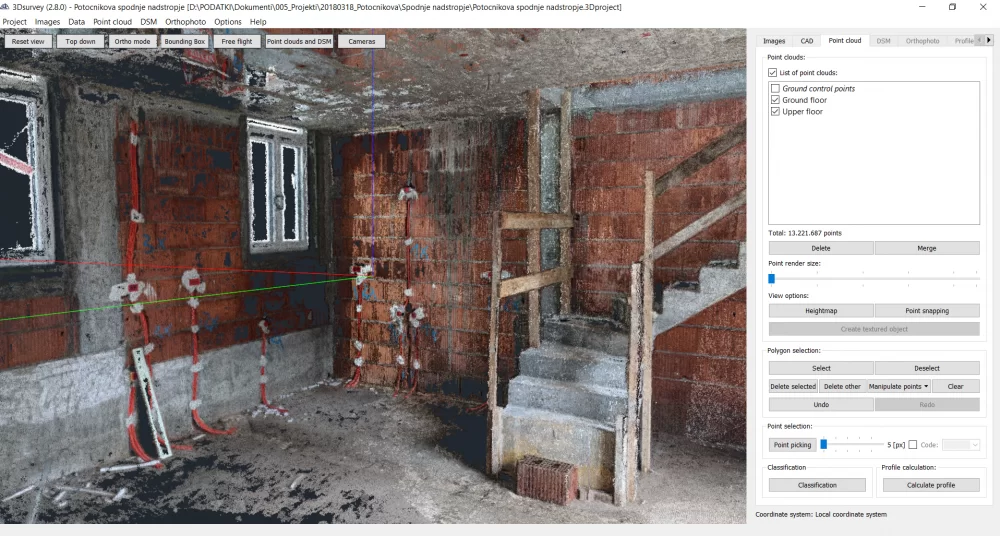
This resulted in 3D point cloud that enables the users to measure the distances between the different elements in the house. For example, the distance between different cables in the wall. It also enabled us to have a documented cross-section of the different layers in the house for future use. We would be able to see the specifics of the desired layer in case we would need it.
The finalized 3D model and corresponding outputs served as a basis for ArchiCAD drawings, modelling of the interior and designing furniture. A detailed digital map – that is measurable and geo-referenced – of electrical and plumbing was generated for further decision making and detailed documentation.
Technical specifications
Tool: Smartphone – Google Pixel I.
Camera: Integrated 12,3 MPIX
Orientation: Local coordinate system – 3 GCP points
Number of images: 182
Flying height: Hand shots
Time of processing data on a high-performance computer: Bundle Adjustment: 6 min; Orientation: 15 min; Dense reconstruction: 6h (on Extreme). Dof, volumes, profiles – on the GO.
DOF Resolution: no orthophoto, just point cloud
Area size: 90 m2
Interested in indoor mapping the interior of your house using a smartphone and GCPs?
Download our GCP targets here. And try 3Dsurvey software free for 14 days. Sign up here.